Albert Park Lake, and surrounding parklands, is known amongst Melburnians as a hub for socialising, recreation, sport, community events and, since 1996, the location of the annual Formula 1® Australian Grand Prix. The creation of the lagoon dates back 8,000 years ago, with the area remaining a significant Aboriginal cultural landscape as part of the traditional Country of the Bunurong People. Details of the ongoing cultural significance of the area for the Bunurong People have not been included below as these will be covered in a future instalment of the Celebrating Local Stories series.
In Part 2 of Shrine to Sea’s Celebrating Local Stories Series, we explore the evolution of natural lagoons to a formalised lake surrounded by a track and parklands.
Locals and tourists alike visit Albert Park Lake and the surrounding areas for a range of activities. Situated about 3km from Melbourne’s city centre, the lake provides space for exercise, sporting activities, dog walking, events and sailing, all with a view of the city’s skyline. But what is now a formalised lake, was created from a network of naturally occurring lagoons along the coast of Port Phillip Bay.
Thriving wetlands
The Albert Park Reserve is one of Victoria’s most popular parklands but once looked very different from the area that we’re familiar with today.
What became the Albert Park Lake began to develop 6,000‒8,000 years ago when sea levels started to fall. At probably its highest point around 8,000 years ago, the tide had lapped along what is now St Kilda Road.
")
Thomas Ham, Plan of Melbourne, 1853. (Source: State Library Victoria)
Many thousands of years earlier, prior to the last glacial event, sea levels were lower and the coastal zone was less swampy. But, as the sea levels rose during a warmer climate, the area was part of a wide estuarine landscape of the Yarra Delta.
 The wetlands that came before the Albert Park Reserve were home to the now-extinct Diprotodons
The wetlands were as diverse as those in the Northern Territory’s Kakadu National Park and were rich in resources, with abundant plant life and a wide array of animal and bird species, including the now-extinct Diprotodons, the largest marsupial ever known to have lived.
Wildlife present in the lake area today includes ducks, swans, possums, bats, native fish, eels, reptiles and over 130 species of birds.
Colonisation and early plans
Exploring Port Phillip Bay in 1803, Charles Grimes, the surveyor-general of New South Wales, recorded that he came to “a salt lagoon about a mile long and quarter of a mile wide”.
This is the earliest documented record of Albert Park from British settlers. Known briefly as Home Park, then as South Park, the Albert Park Reserve developed from the 1860s as an oasis of open space within what became a crowded residential area. But this landscape has a much longer history that has changed slowly and dramatically through deep time to the present and will continue to evolve into the future.

Alfred R.C. Selwyn, Geological Survey of Victoria, 1860, showing the study area. (Source: National Library of Australia)

Detail from Map of Melbourne and surrounds (Frederick Proeschel, c1851–69) showing Kerferd Road (‘Beach Road’) and Albert Park Lake. (Source: National Library of Australia)
Detail from H.L. Cox’s plan of Melbourne, 1864. (Source: State Library Victoria)
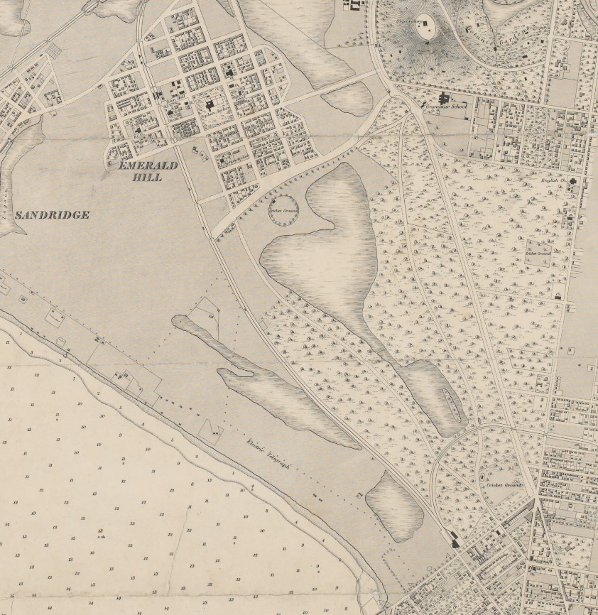
Where St Kilda Road marks the change from low ground to higher ground, Albert Road (formerly known as Beach Road) also reflects something of the earlier landscape. The road’s current alignment was laid out many years before Albert Park Lake was formed, with its curved route following the edge of the former lagoon.
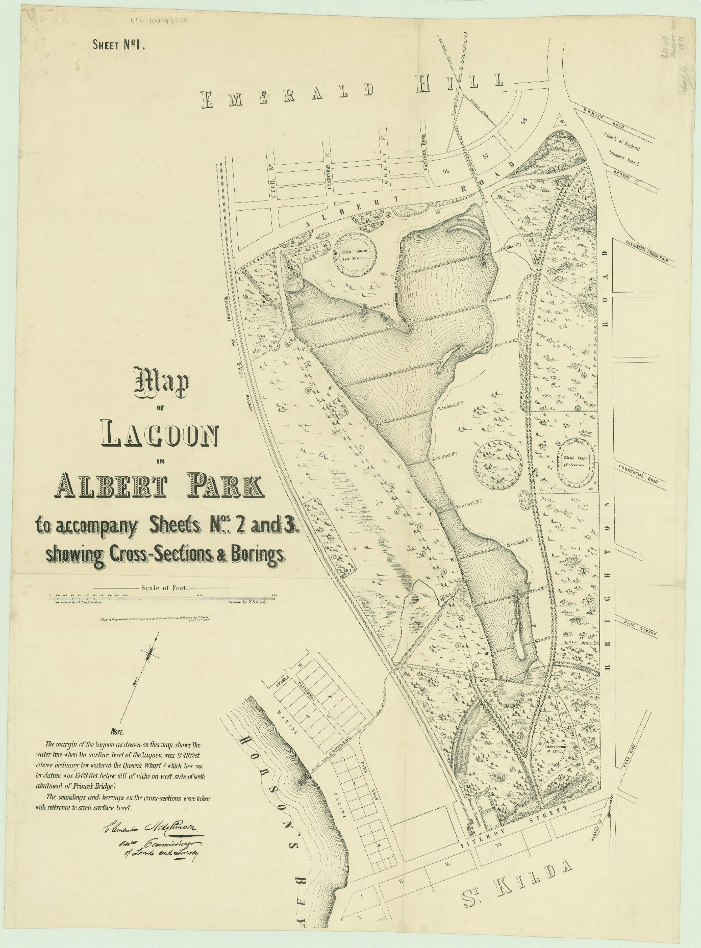
Map of the lagoon in Albert Park 1871, showing the altered state of the swamp and waterholes. (Source: State Library Victoria)
Forming a lake
In the 1830s, colonial settlers decided to drain the lagoon and form a lake as a means of controlling and containing the ‘swamp’, They saw the area as of little value despite its abundant resources and breeding ground for birdlife. This would also make way for housing, agriculture and cattle grazing. In 1864, the land was declared a public parkland, named after Queen Victoria’s consort, Prince Albert.
However, despite the will of engineers in the 1870’s to form a defined lake, nature found her own path. At times of heavy rain, the lake would return to its original state as an uncontained body of water following the landscape contours. It took some 20 years to complete the works. The informal track around its edge was also being progressively formalised to enable promenading and to help create the ideal of the ‘gentleman’s park’ laid out in a picturesque style, complete with wide lawns, exotic specimen trees, inviting views to and across the lake.
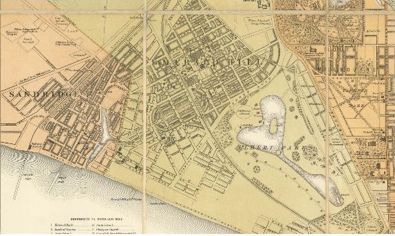
Detail from a map of Melbourne, c1880s showing the layout of roads and formalisation of Albert Park Lake. (Source: State Library Victoria)
Still, some native plants remained, and the varied birdlife has continued to frequent the area, nurtured back over decades by the efforts of friends groups and park management to balance the multiple uses of the park.
More recently, the Albert Park Masterplan has set plans for further softening of the hard lake edge with new wetlands that support a richer aquatic habitat and an inviting fringe for visitors. After the dramatic draining of the lagoons, and development of a hard-edged lake, the vision is now shifting back, albeit modestly, to embrace a more biodiverse environment.
Today, millions of visitors continue to enjoy the area for promenading, recreating, fitness and socialising with perhaps little idea that the formalised urban lake was once a rich, wild series of wetland and lagoons for thousands of years before.
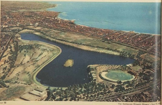
Aerial view of Albert Park Lake 1959 (Source: The Australian Women’s Weekly 1959)
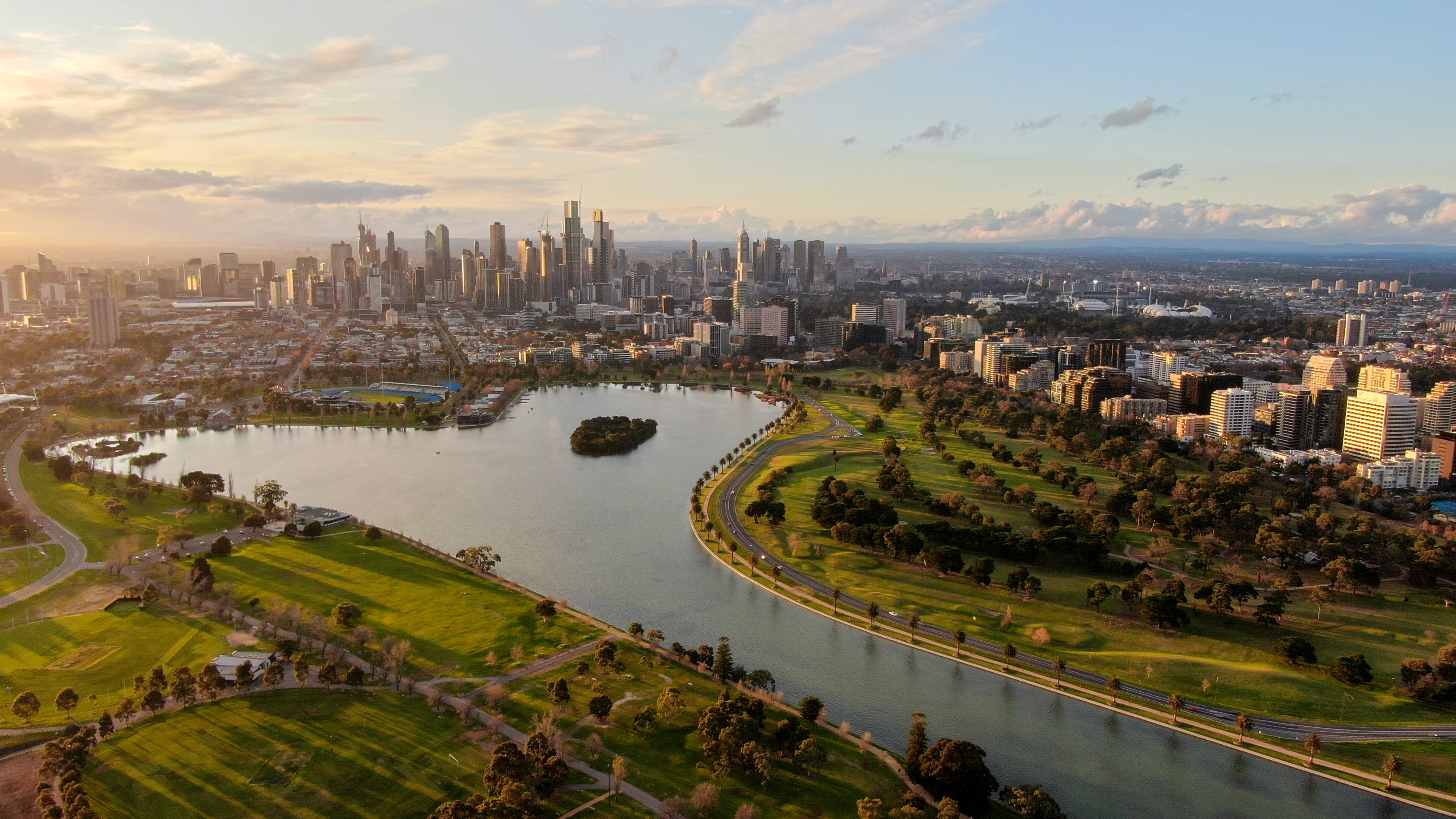
Albert Park Lake as we know it today
This is just one of many exciting historical stories from the local Shrine to Sea area. Stay tuned for more stories celebrating the area's exciting history.
Page last updated: 25/10/22